The walker foundary site at Burcroft conisborough,so far dont know much about this.
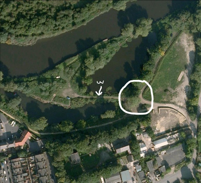
Studying old maps I have been able to work out that the site became the don saw mill after the walkers left.The weir for powering the mill is now just a bridge marked by the w in this google earth view.The ringed area marks the site of the works that was sketched by turner in 1797.
Below is a 1892 map with the area above.Don saw mill marks the site of the walker works along with the weir used to power the mill
The swing lock bridge allowed access for barges,other wise it would have meant a rough ride over the weir!
